 The mission of SpatialSci is to provide educators with a sustained environment for the integration of geo-technologies into classroom instruction. From relevant spatial data sets to GIS-based curriculum, SpatialSci is a one stop shop for teachers committed to implementing geo-technologies into K-12 classroom instruction.
Geo-technologies are used daily in so many aspects of human activity that many predict it will one day be a required basic skill set just as word processing is today (Alibrandi, 2003). If you have ever pulled a travel map off the internet, you have used GIS. If you watched last night’s weather report, you viewed a geographic information system. GIS simply combines layers of information about a place, such as cloud cover and temperature, to better understand that place.
K-12 Educational GIS Grant sponsored by MAGIP
- January 20, 2012 request for proposals for a $1,000 grant to support the development and use of geospatial technologies in the K-12 classroom to include curriculum development, training, and equipment that will enhance geospatial instruction. This grant has historically been awarded exclusively for the development of curricula to bring Geographic Information Systems (GIS) into the classroom. However, in light of the successful projects we have sponsored in the past, MAGIP has expanded the range of qualified grant uses to encourage further integration of GIS in the K-12 classroom.
Google Tools Workshop - Bozeman (August 24, 2011)
- August 10, 2011Are you looking for ways to integrate technology into your classroom? Have you heard the buzz about Google Docs but aren't quite sure what to make of it? Do you want to go into this school year with new ideas about how to transform your classroom? If you answered yes to any of these questions then this workshop is for you.Whether you are a beginning technology user, an old pro, this workshop will help you to better understand how teachers across the country are using the Google Docs Suite to revolutionize their classrooms.
Google Earth Workshops - Summer 2011
- June 23, 2011Are you looking for a summer workshop that will change the way you teach? Are you hoping to do more with technology in your classroom but don't know how? Well this is the workshop for you. Come and experience the power of Google Earth and how it can be used across the curriculum to transform your teaching practice and in turn empower your students to learn about their natural world.
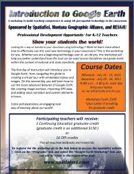 This two day hands-on workshop will cover the basic functions of Google Earth, including navigation skills, feature analysis, creating data, and organizing and sharing data. We will also work with GPS receivers, collecting data and importing that data into Google Earth. Participants will have an opportunity to explore lessons created by teachers that integrate Google Earth. Each participant will create their own Google Earth tour they can take back and use in their classrooms.
If you are looking for a fun and interactive professional development experience this summer then this is the workshop for you. Click on the link below to register for the workshop. You can choose between Missoula (July 14th and 15th) or Bozeman (July 25th and 26th). Each workshop can be taken for 1 graduate credit ($150 fee) or 16 OPI renewal units.
A Teachers' Introduction to Google Earth and GPS Receivers
- June 22, 2011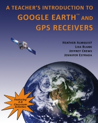
This book will help K-12 teachers become familiar with the basic features of Google Earth and GPS receivers so that they can bring these technologies into the classroom and provide their students with significant and engaging opportunities to conduct place-based research on diverse subjects with a spatial dimension.
This book will walk you through the basic steps of navigating Google Earth, analyzing features, formatting and sharing placemarks, and organizing and sharing data. This book also covers GPS basics and outlines how to import the data you collect with your GPS into Google Earth. Each lesson is organized in an easy to follow step-by-step format making it easy to complete the activities.
Each activity includes colorful pictures and graphics to help users understand the more complex features of the program. Users of this book will soon be creating their own virtual tours in Google Earth.
As an added bonus, there are several teacher created lessons you can use in your classroom to help embed this transformative tool into your practice.
A Few Good Mapping and GIS Tools
- September 11, 2008Imagine that you want to show your constituents where they can buy fair-trade coffee, or represent to decision-makers the lack of doctors in a particular region of town. Perhaps you want to communicate the disparities of housing levels and heath indicators across different counties, or show the impact of polluted rivers on the surrounding environment.
These things are hard to effectively convey in writing, but a map can be worth a thousand words.
Enter GIS. Geographical Information Systems provide tools to display and analyze information geographically. By layering information on top of a map, we can visually represent data in a way that can be readily understood by a large audience. Maps can reveal significant data relationships that are difficult to comprehend otherwise.
|
|
 |
|
|
|
|
|
||
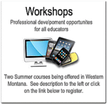
Summer 2012 Professional Development Opportunites...
Sign up for one of our summer workshops. Each class is two days of hands-on exploration. One optional graduate credit or 16 OPI renewal units available. Click the link below to register.
» May 2006
» June 2006
» July 2006
» October 2006
» December 2006
» February 2007
» May 2007
» June 2007
» September 2007
» July 2008
» September 2008
» June 2011
» December 2010
» August 2011
» January 2012
» May 2012
Recent Tweets From @spatialsci