|
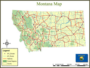
The GIS 4 Montana initiative is a State-wide K-12 license for ArcGIS, made available free of charge to Montana’s public schools through an agreement between the SpatialSci Project, The University of Montana, GeoEssentials, and ESRI. Every K-12 public school in the state of Montana has the option to capitalize on this program that includes the latest ESRI GIS software. ArcGIS Geographic Information System (GIS) is a mapping software that links information about where things are with information about what things are. It is a tool used for manipulating, creating, analyzing, and displaying spatial data. With GIS, teachers can provide students an opportunity and motive for investigating more deeply, exploring more completely, and thinking more creatively about the world we live in. GIS technology is appropriate for any age.
|
To learn more about GIS click here... To change license information click here... For help with installling ArcGIS 10.0 click here... To view all available GIS data sets click here... To view a video of why geography matters click here... To view a GIS introduction video click here... To learn how GIS is used in everyday life click here...
|
Programs >> GIS 4 MT
|
|
 |
|
|
|
|
|
||
Summer 2012 Professional Development Opportunites...
Sign up for one of our summer workshops. Each class is two days of hands-on exploration. One optional graduate credit or 16 OPI renewal units available. Click the link below to register.
» May 2006
» June 2006
» July 2006
» October 2006
» December 2006
» February 2007
» May 2007
» June 2007
» September 2007
» July 2008
» September 2008
» June 2011
» December 2010
» August 2011
» January 2012
» May 2012
Recent Tweets From @spatialsci
- October 09, 2012 -
SpatialSci: NASA Earth Observato Auroras over North America: A geomagnetic storm in early October lit up the skies with nort... http://t.co/RYtYA17b
- October 09, 2012 -
SpatialSci: GIS in Edu: Video Game That Uses Google Earth (VIDEO): Geoception, Inc is doing a project that will utilize Goog... http://t.co/8wBqfz8p
- October 09, 2012 -
SpatialSci: NASA Earth Observato New posts in the Notes from the Field blog - Hello, Knorr? It's The International Space Sta... http://t.co/hOlZY6aB
- October 09, 2012 -
SpatialSci: Google Earth Blog: Viewing the ash plume from the Shiveluch Volcano: Just a few days ago we talked about some of... http://t.co/6jtJVY26
- October 08, 2012 -
SpatialSci: NASA Earth Observato Ash Plume from Shiveluch: Acquired a little less than two hours apart, these images show a ... http://t.co/vvEYwAwu
- October 08, 2012 -
SpatialSci: Garmin Blog Stand Out From the Pack with Garmin Special Edition Forerunner 210 & 610:
On a day where we saw two... http://t.co/cYKmnJkO